


Uttarakhand flood maps may be underestimating risk, study warns

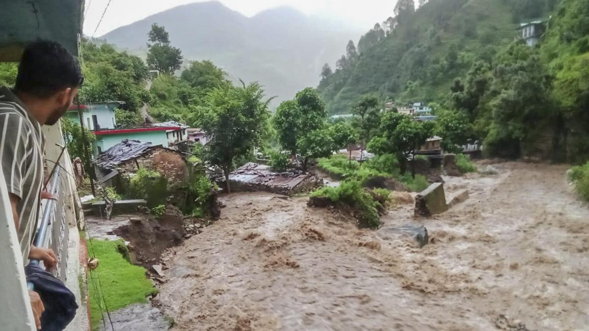
A flood-like situation in a village in Chamoli, Uttarakhand, following heavy rains is seen in this July 8, 2025, photograph.
| Photo Credit: PTI
Flood hazard assessments for Uttarakhand have routinely underestimated the danger to its towns and villages because they have leaned on long-term average rainfall figures rather than the extreme downpours that actually trigger disasters, according to a study in Current Science. The findings arrive at a moment when the Himalayan state is grappling with what climate scientists describe as a sharpening pattern of cloudbursts, glacial lake outbursts, and flash floods.
The study, led by researchers at the Malaviya National Institute of Technology, Jaipur, tracked how flood hazard zones have intensified in 2017-2021. Areas classified as ‘high’ or ‘severe hazard’ zones rose noticeably over that period, with 2021 showing the largest extent of ‘high-hazard’ land. Across all the years examined, more than 90% of Uttarakhand fell within moderate or high-hazard categories.
The researchers mapped flood hazard zones across Uttarakhand using a Geographic Information System (GIS), a popular digital mapping technology used by planners everywhere. They combined six factors to assess where floods are most likely: elevation, slope, drainage density, topographic wetness, land use, and rainfall. Each factor was assigned a weight reflecting its influence on flooding. Slope, elevation, and rainfall were judged the most important; land use, drainage density and wetness were treated as secondary.
The map was then drawn once using the highest rainfall recorded in a given year and once using the average of those annual peaks across three decades. The contrast was stark. When the heaviest yearly rainfall was used, severe and high-hazard zones expanded across the state. When long-term averages were used instead, those zones appeared to shrink. The authors argued that conventional methods relying on average values may give planners a false sense of safety.
The findings carry weight in a state that has witnessed a series of catastrophes over the last two decades, from the Malpa landslide of 1998 and the Kedarnath disaster of 2013, in which Uttarakhand received 375% of its benchmark monsoon rainfall, to the Chamoli flood of 2021. Climate scientists have linked the rising frequency of extreme rainfall in the Himalayas to a warming atmosphere. Built-up areas, the study noted, have also expanded across the State, leaving less land able to absorb runoff.
The authors recommend flood maps be redrawn around extreme rainfall scenarios rather than long-term averages, and that buffer zones be created around the most vulnerable terrain. Field validation against observed flood data, they added, will be essential before such maps guide policy decisions.
Published – May 08, 2026 07:45 am IST